Dunsmuir Flood History
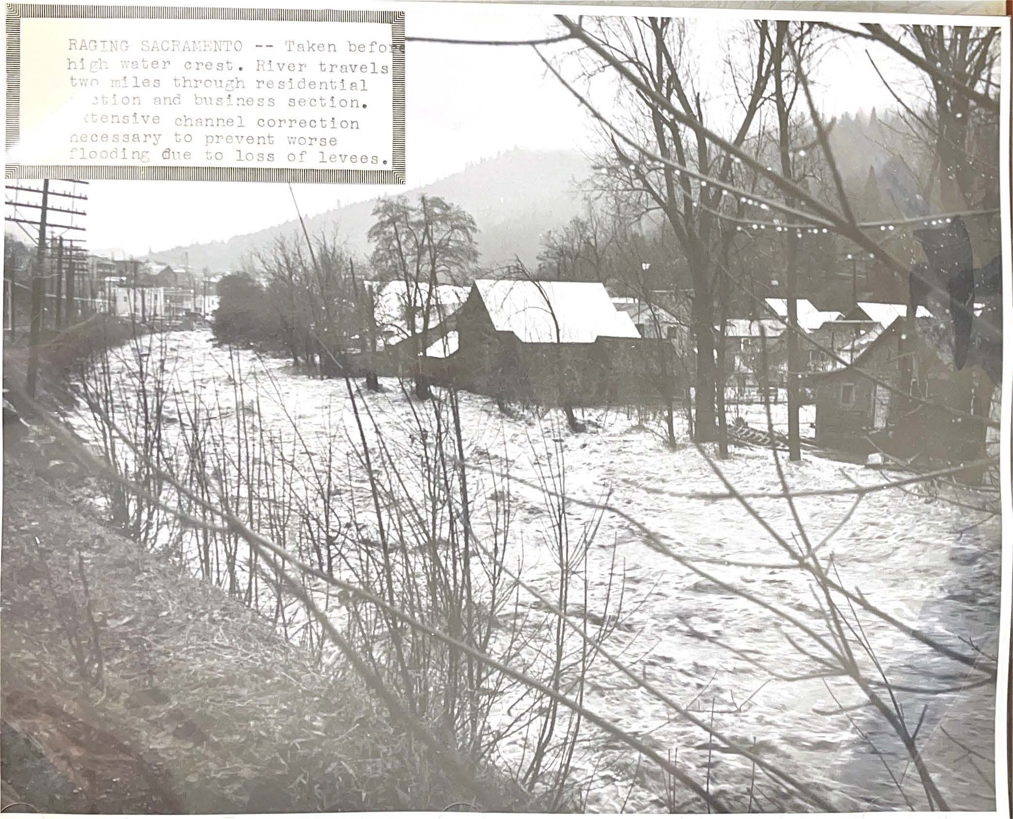
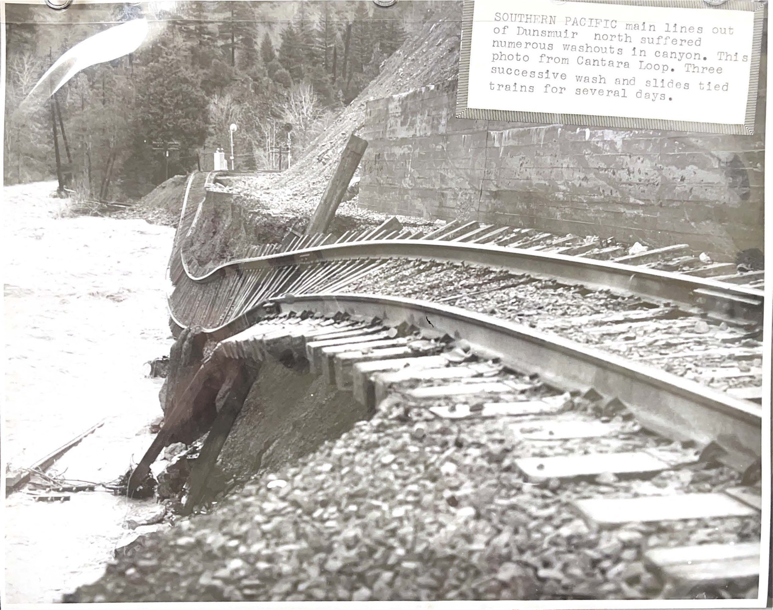
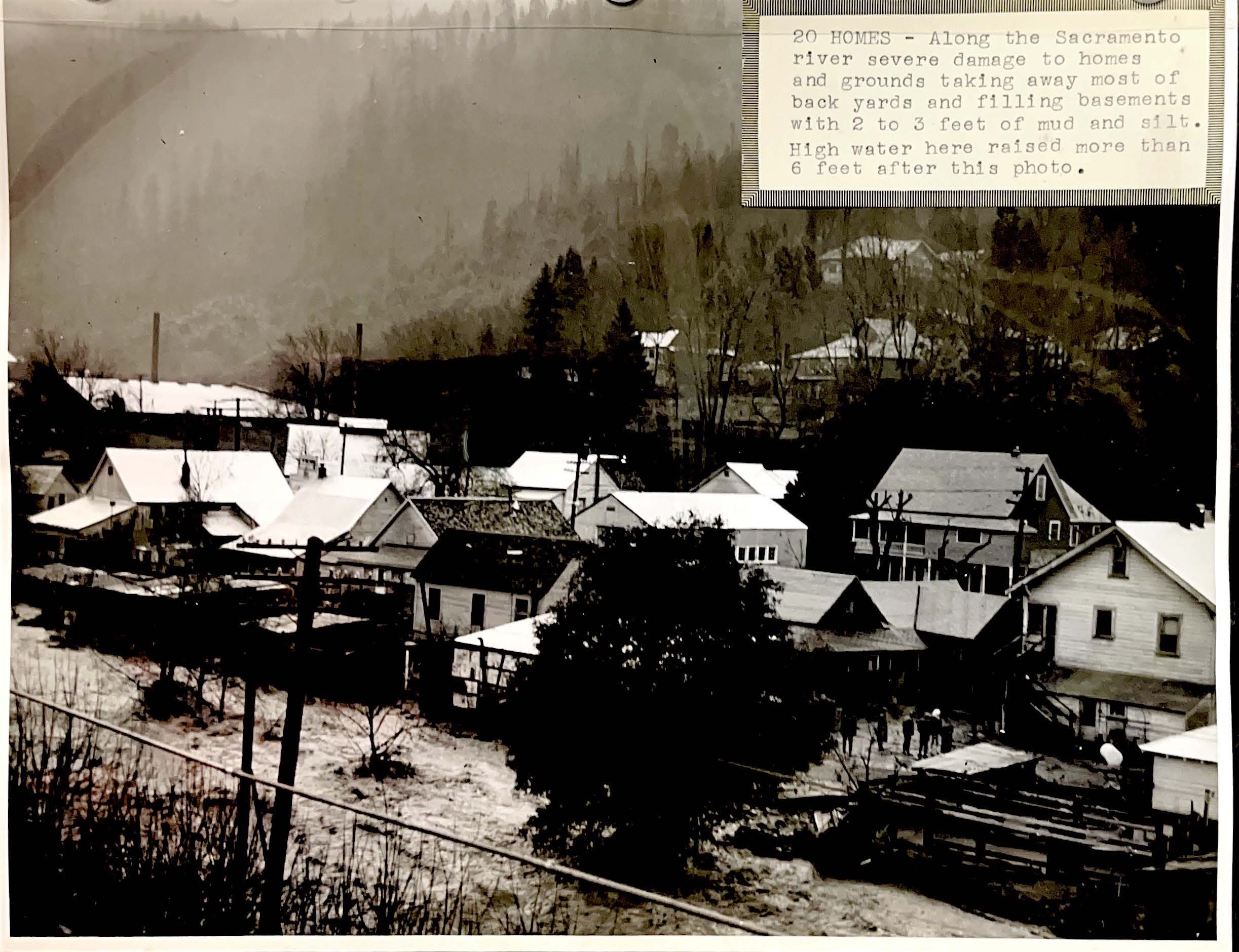
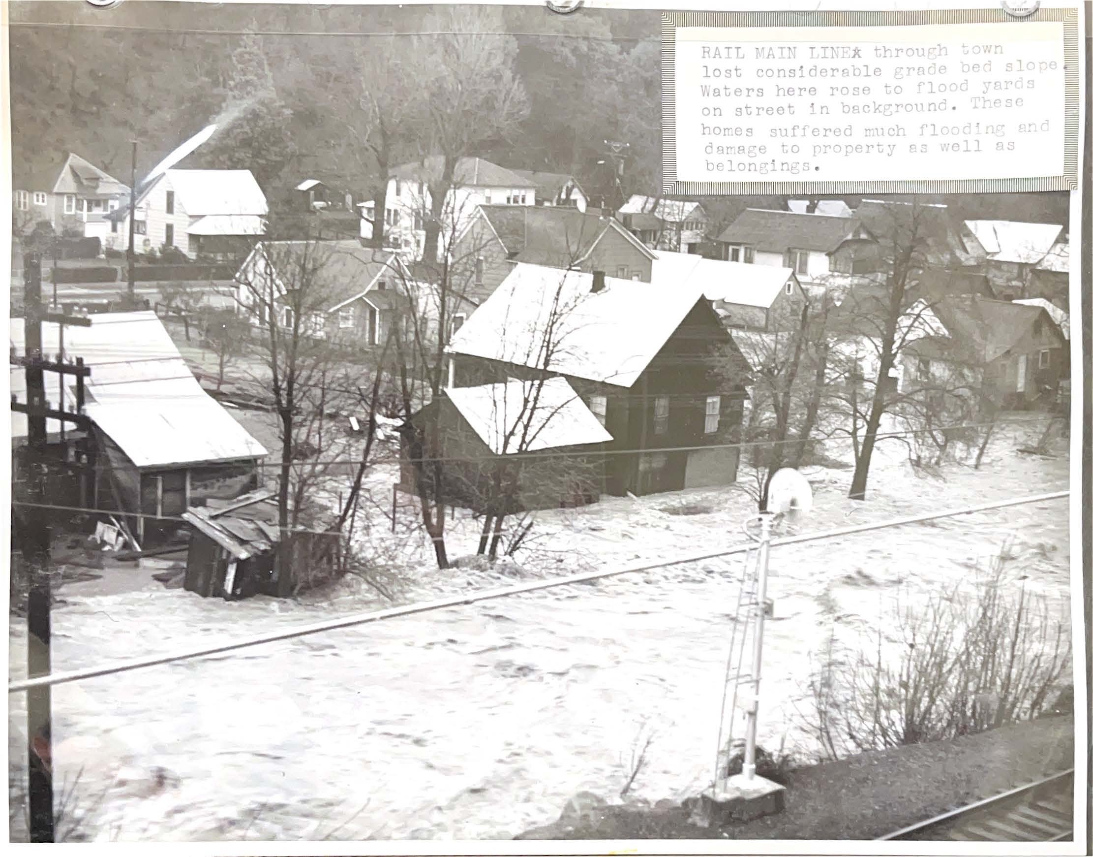
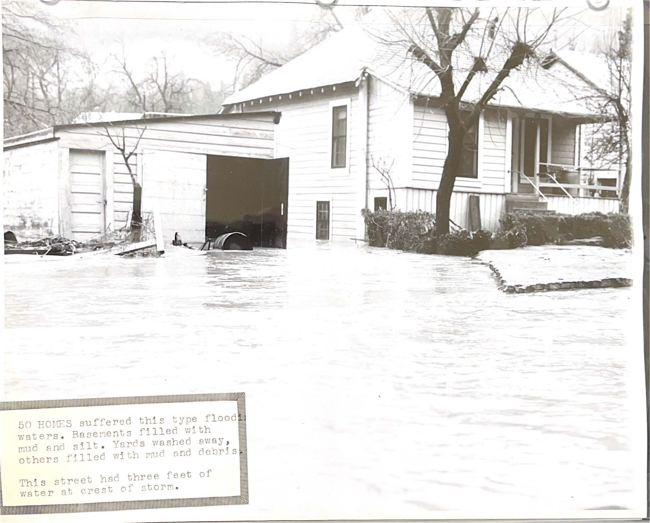
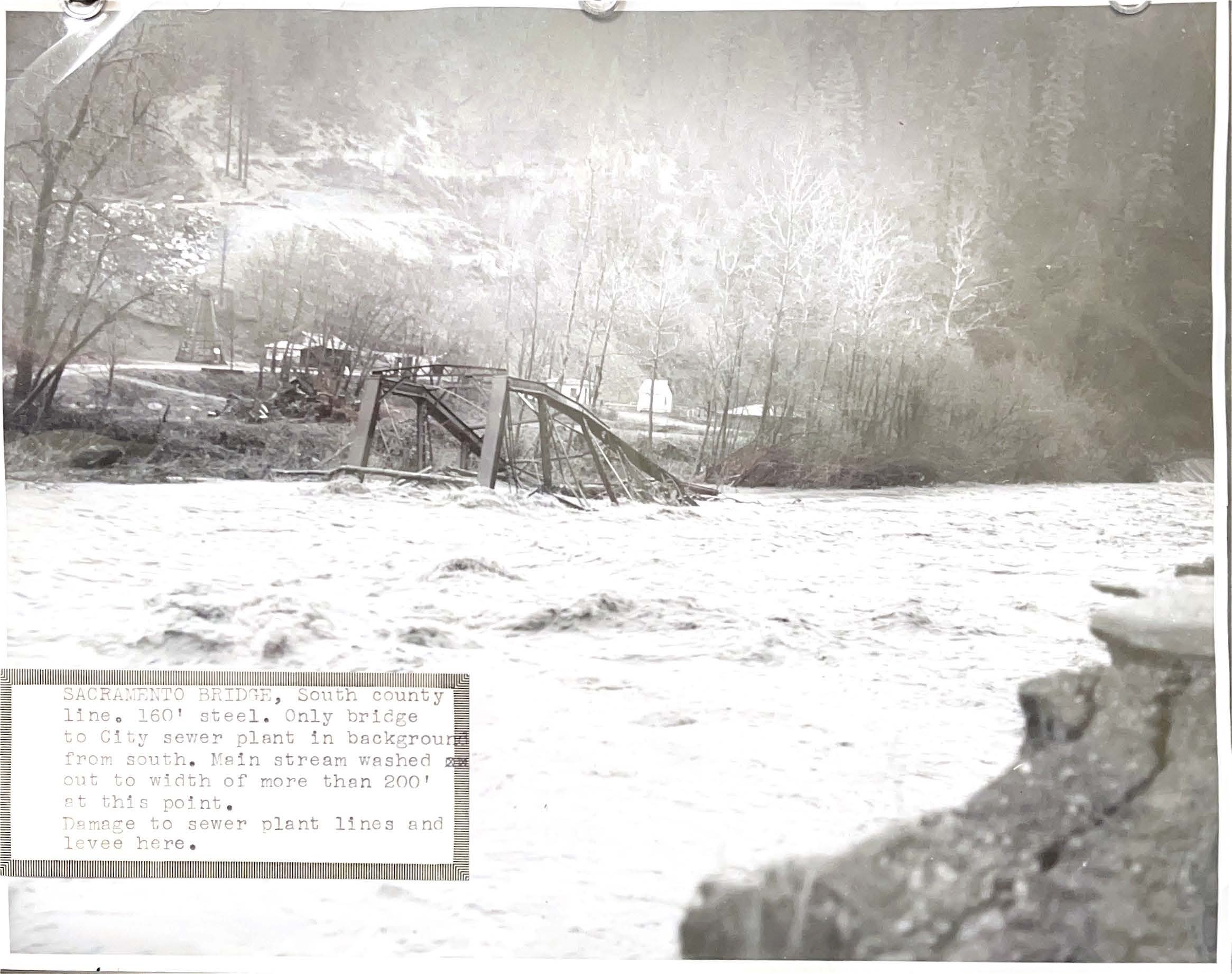
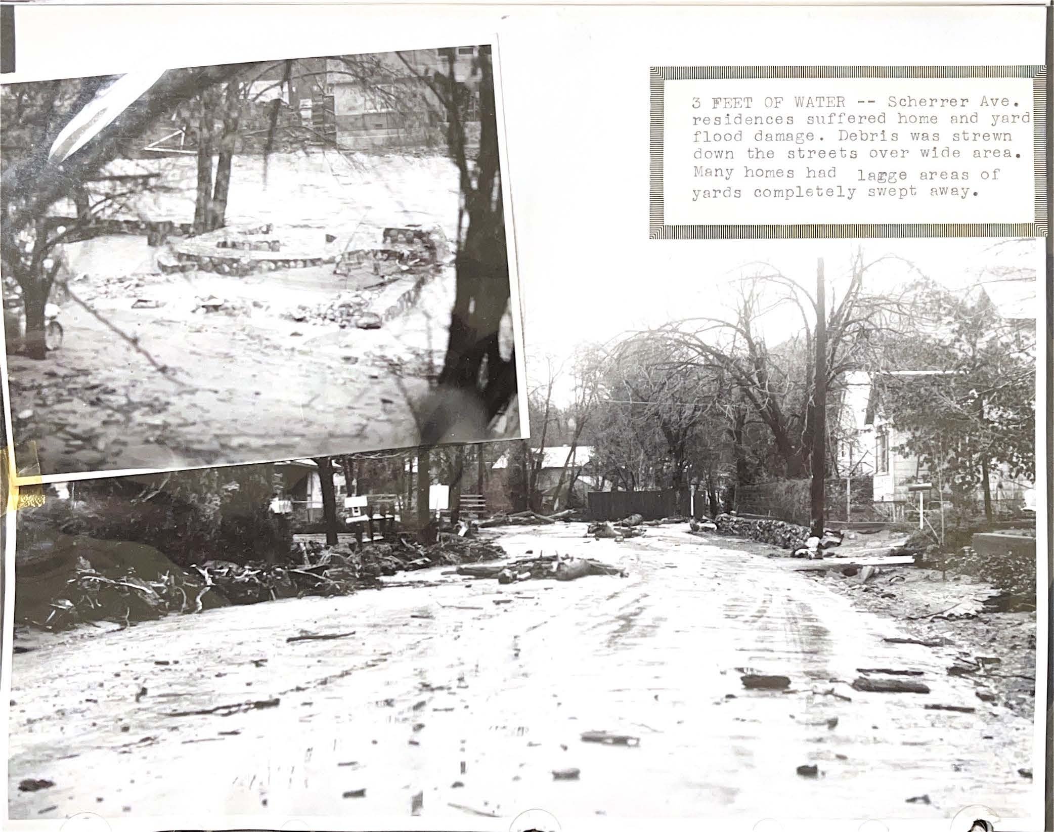
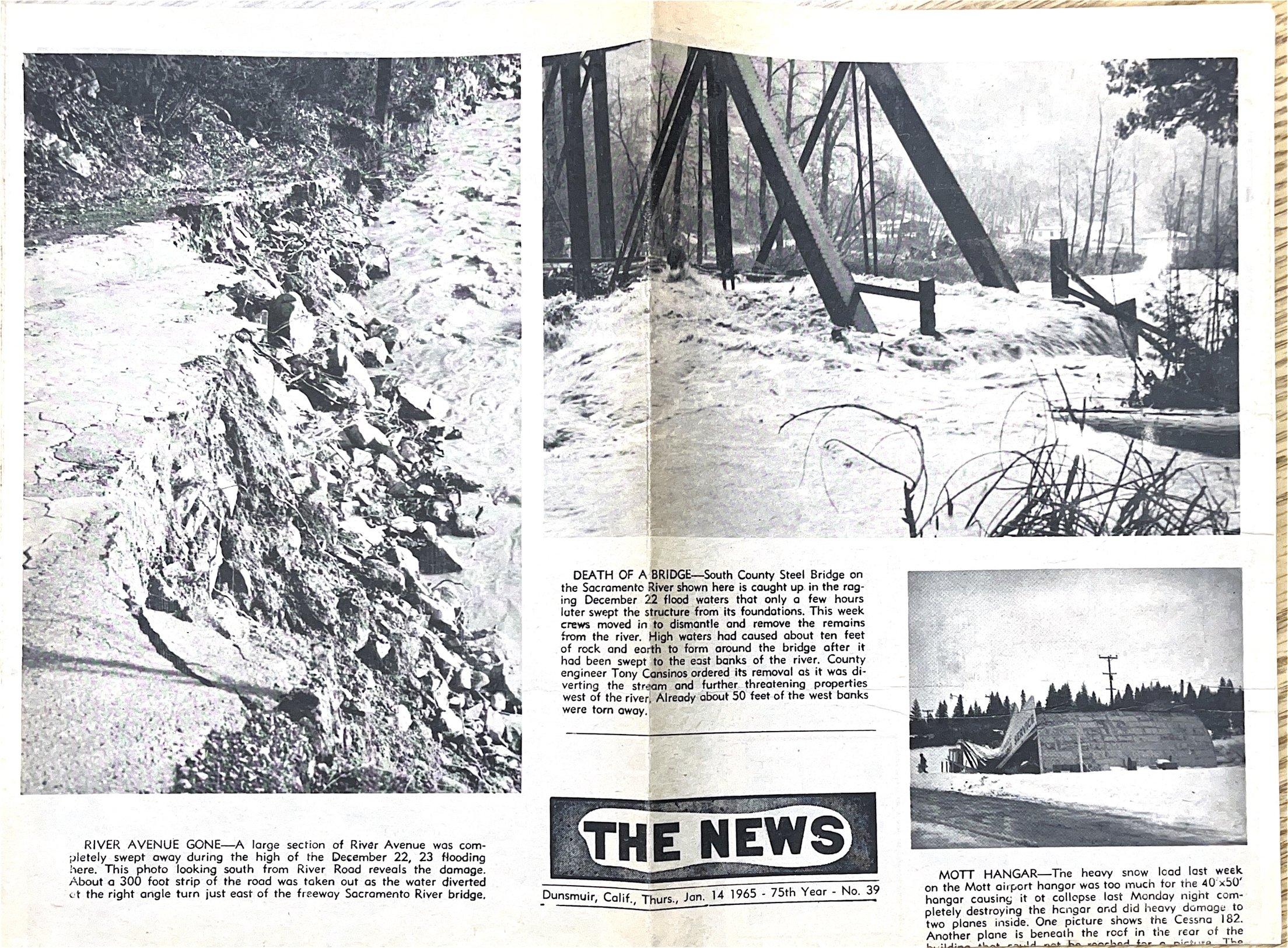
Dunsmuir has experienced flooding regularly over the last 100 years. Major flood events occurred in 1914, 1916, 1940, 1955, 1964, 1974, 1997, and 2017. The city’s two most devastating floods occurred in 1964 and 1974 after the completion of the Box Canyon Dam. Both the 1964 and 1974 floods damaged and destroyed homes and washed out bridges, sections of roads, and railroad beds in Dunsmuir. Pictures of both floods are shown in slideshows at the bottom of this page.
Sandbags are available for community members to fill and take at the Dunsmuir Ball Field parking lot (4841Dunsmuir Ave).
Are you in the Floodplain?
Over 200 homes in Dunsmuir are located within the floodplain, and not all 200 homes are located along the Sacramento River. Alder Creek, at the south end of town, also has a floodplain that includes several blocks south of City Hall, shown in the map below.

To find out if you are in a FEMA floodplain click the “FEMA Flood Map Search” button below.
Did you know…..
That 40% of National Flood Insurance Program claims occur outside of high-risk flood areas! This means that having flood insurance is still a good idea even if you aren’t in a mapped floodplain.
Or that 1” of water in your home can cause more than $25,000 in damages?
Or that the maximum amount FEMA will give you to rebuild or repair your home in a disaster is only $42,500.
Or that most homeowners’ and renters’ insurance policies do not cover flooding, so you have to ask your insurance company for a flood insurance policy specifically.
Pictures of the 1974 Flood
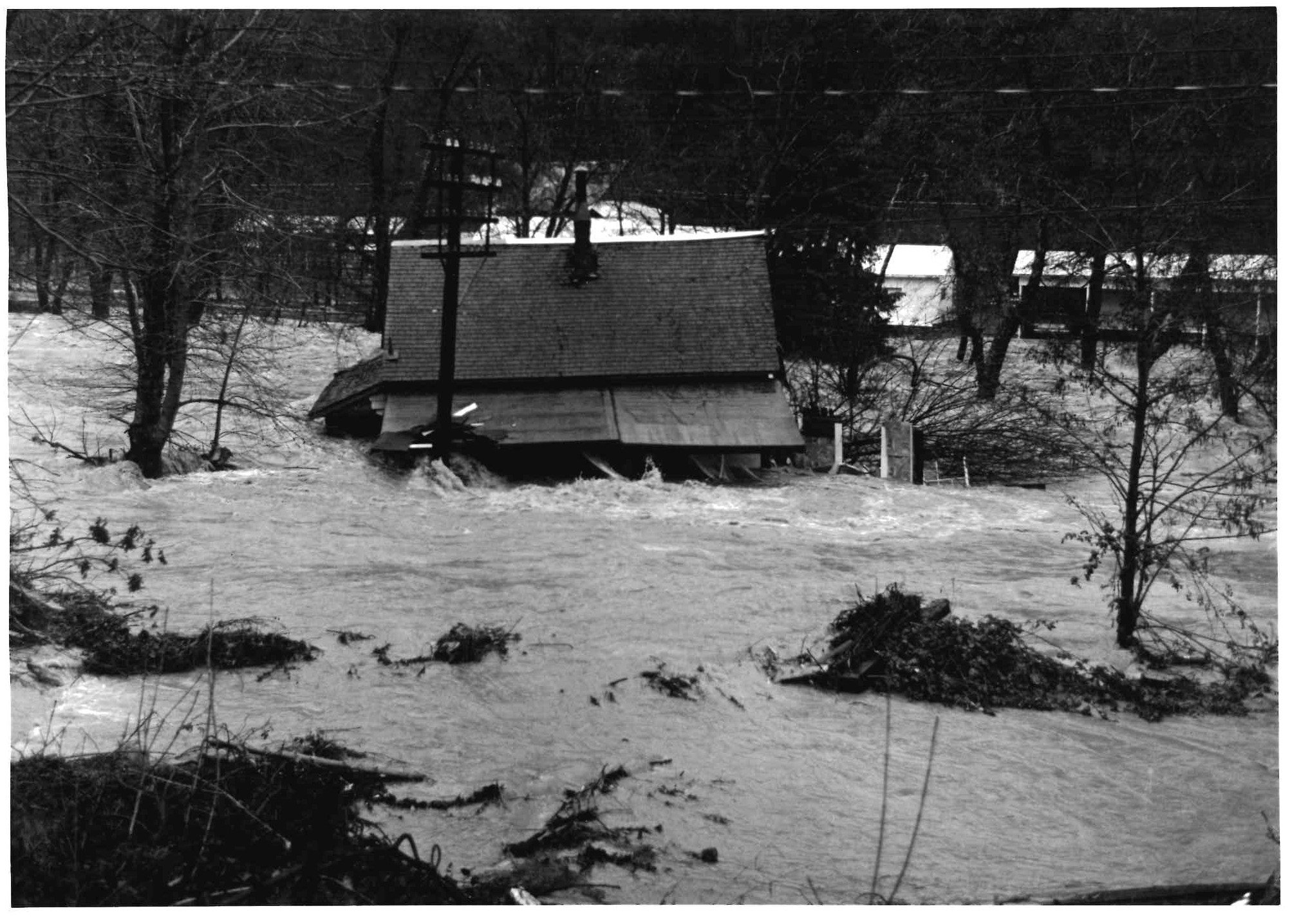
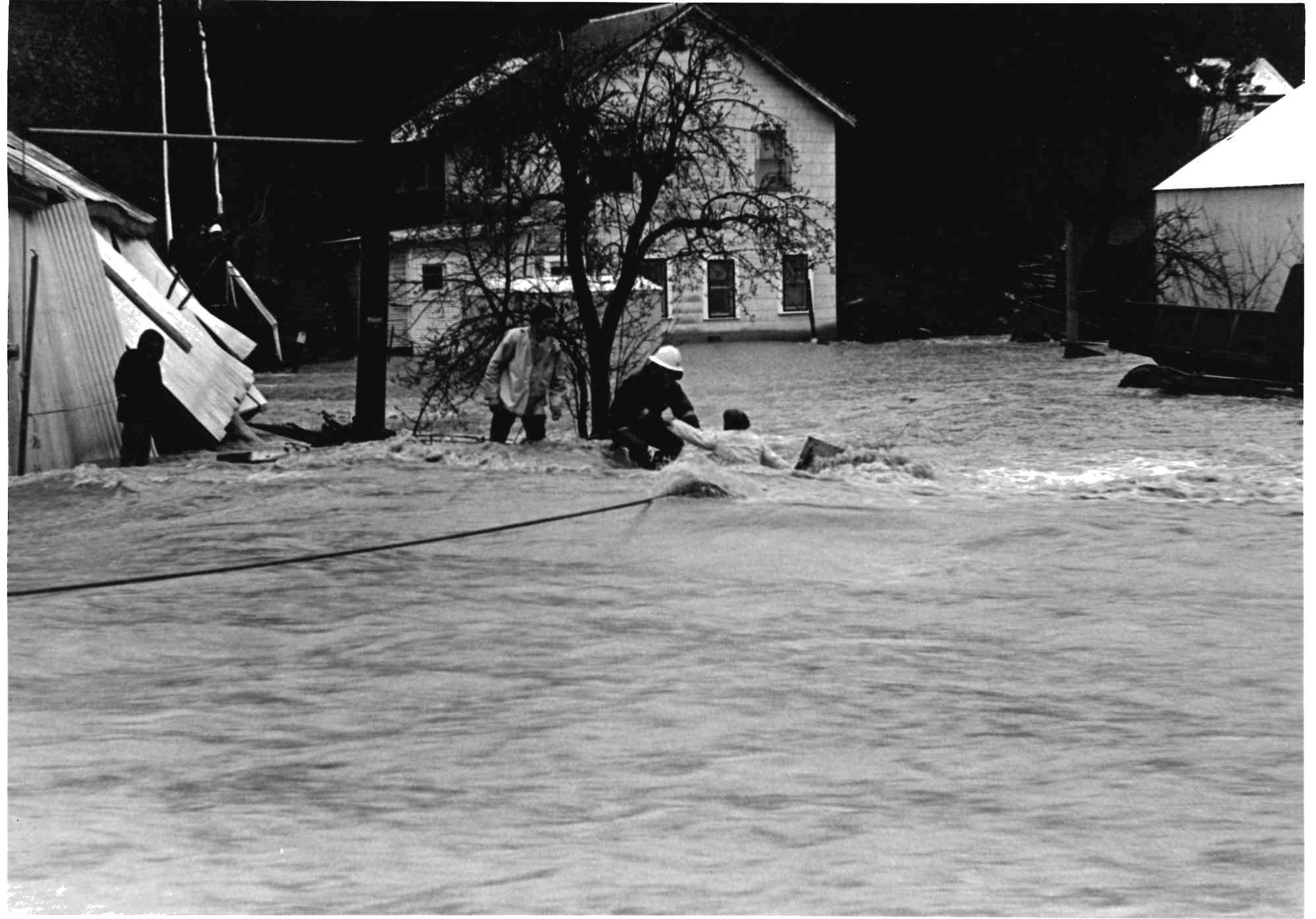
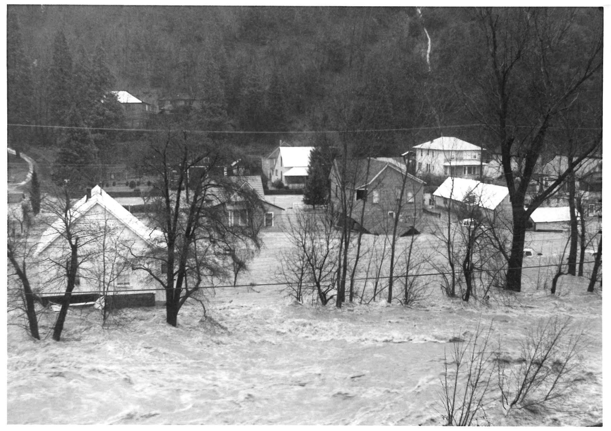
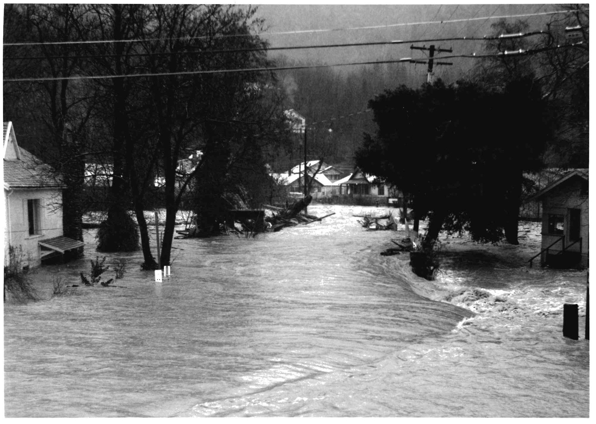
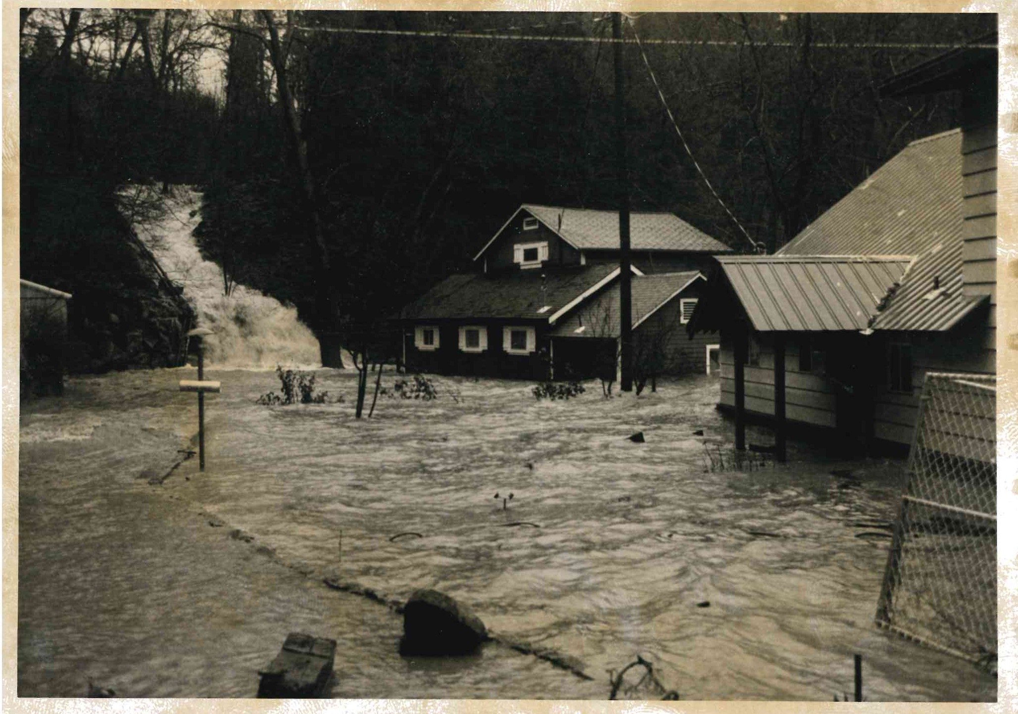

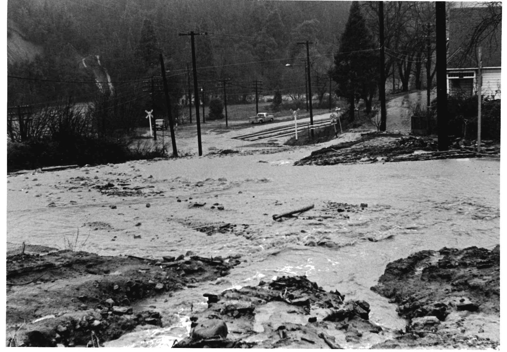
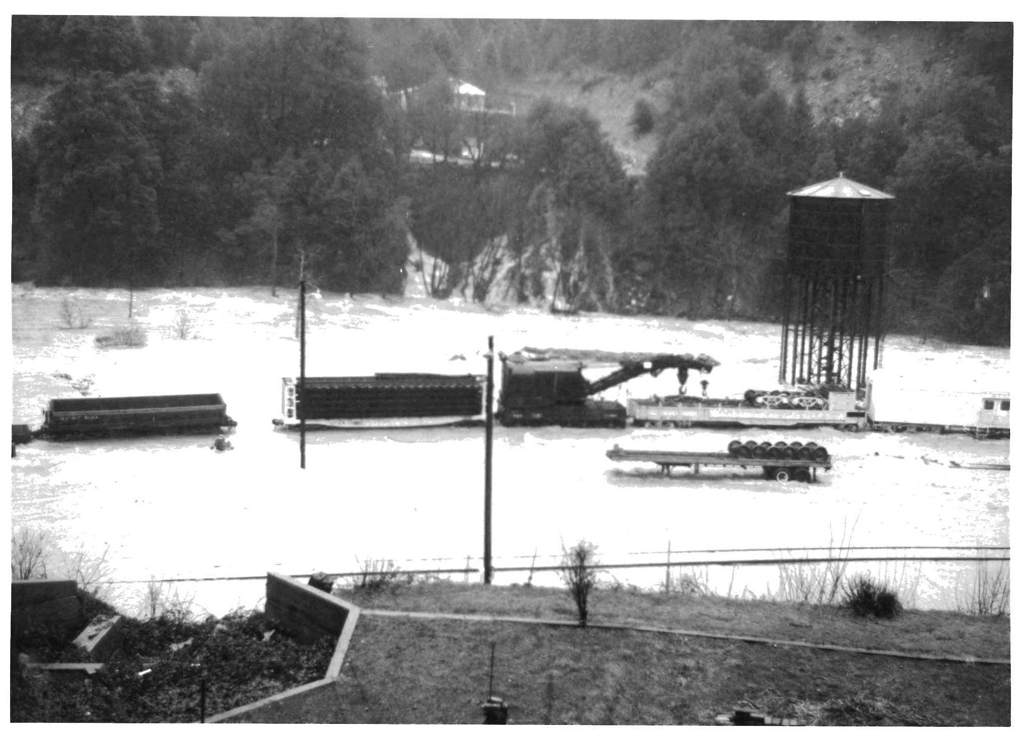
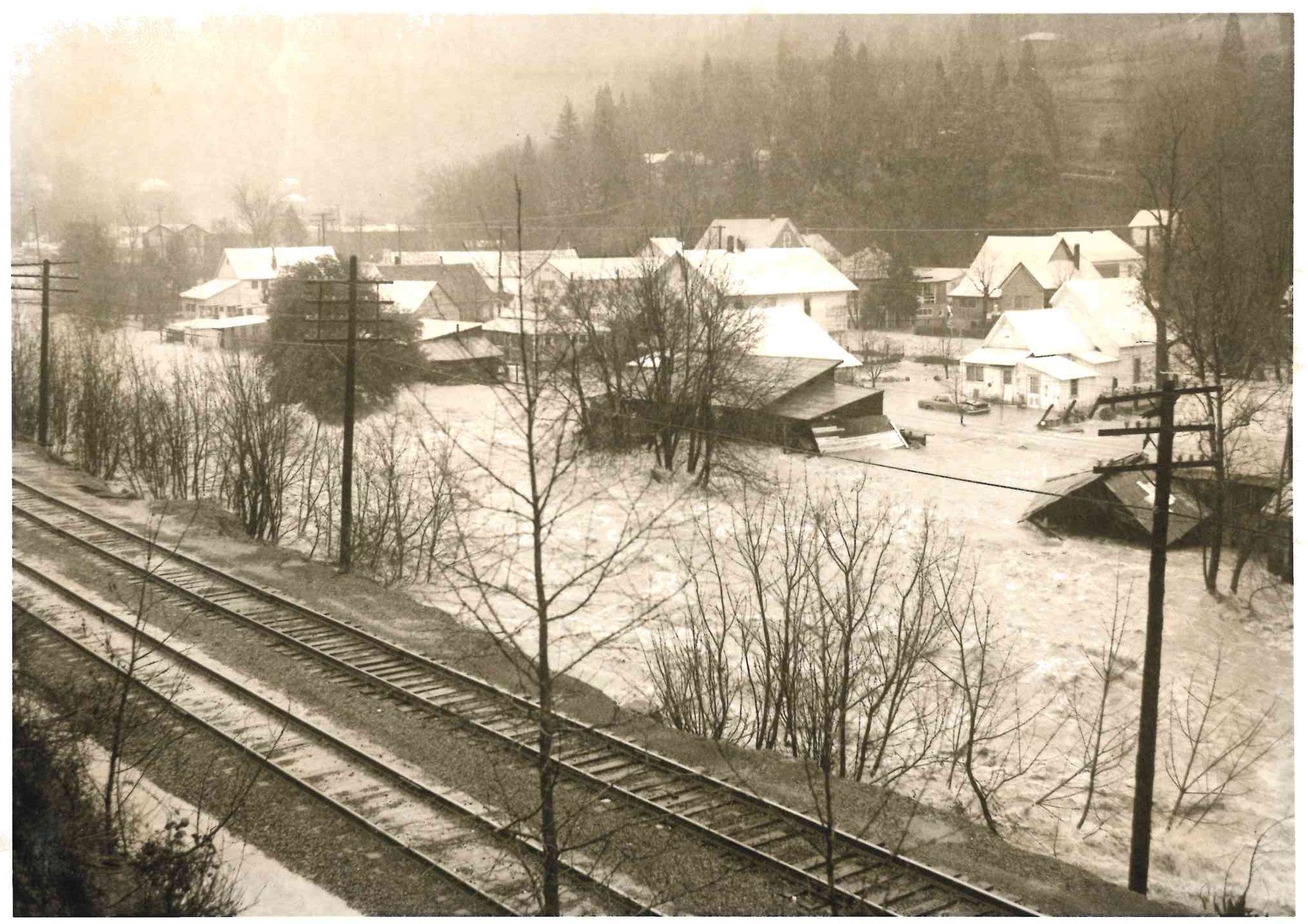
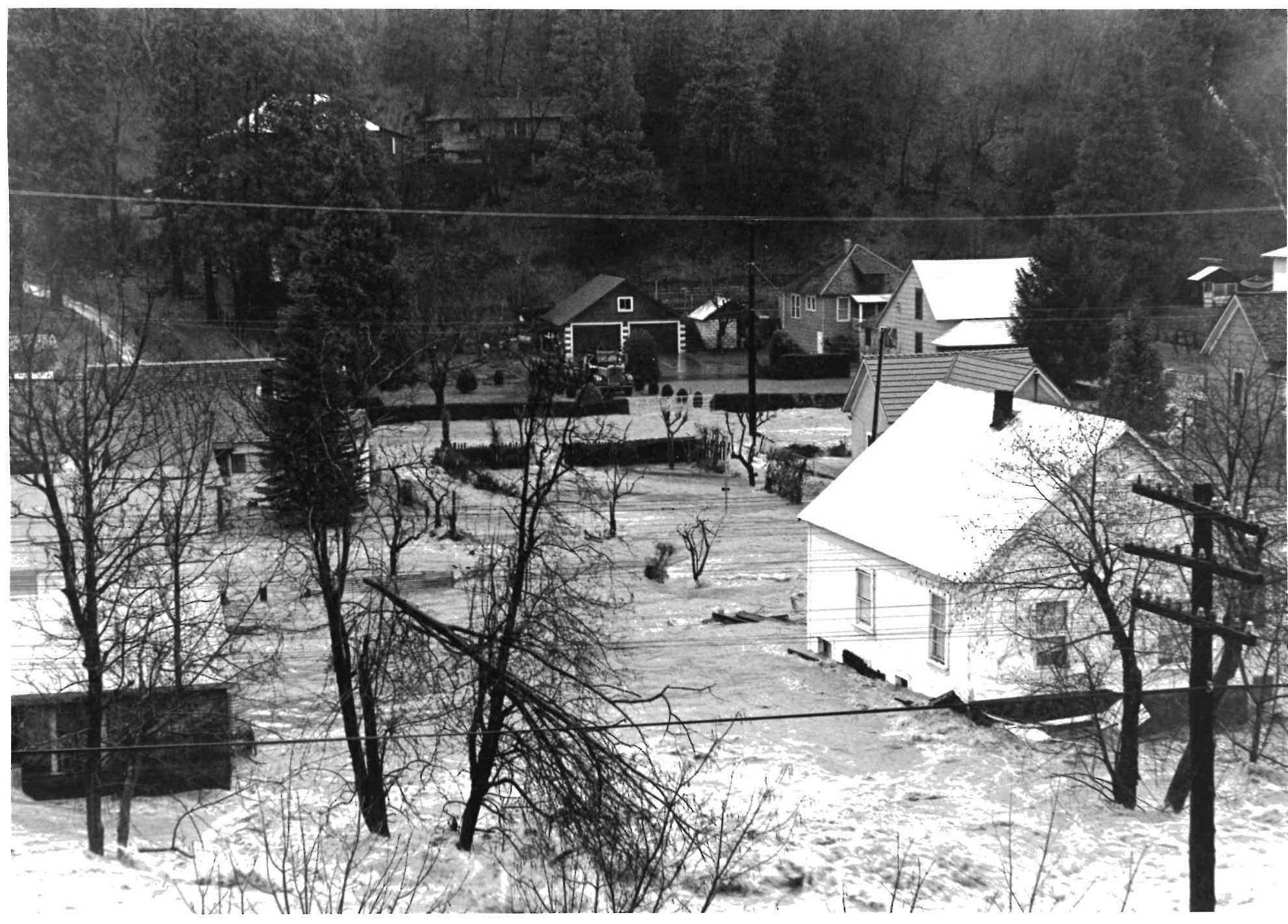
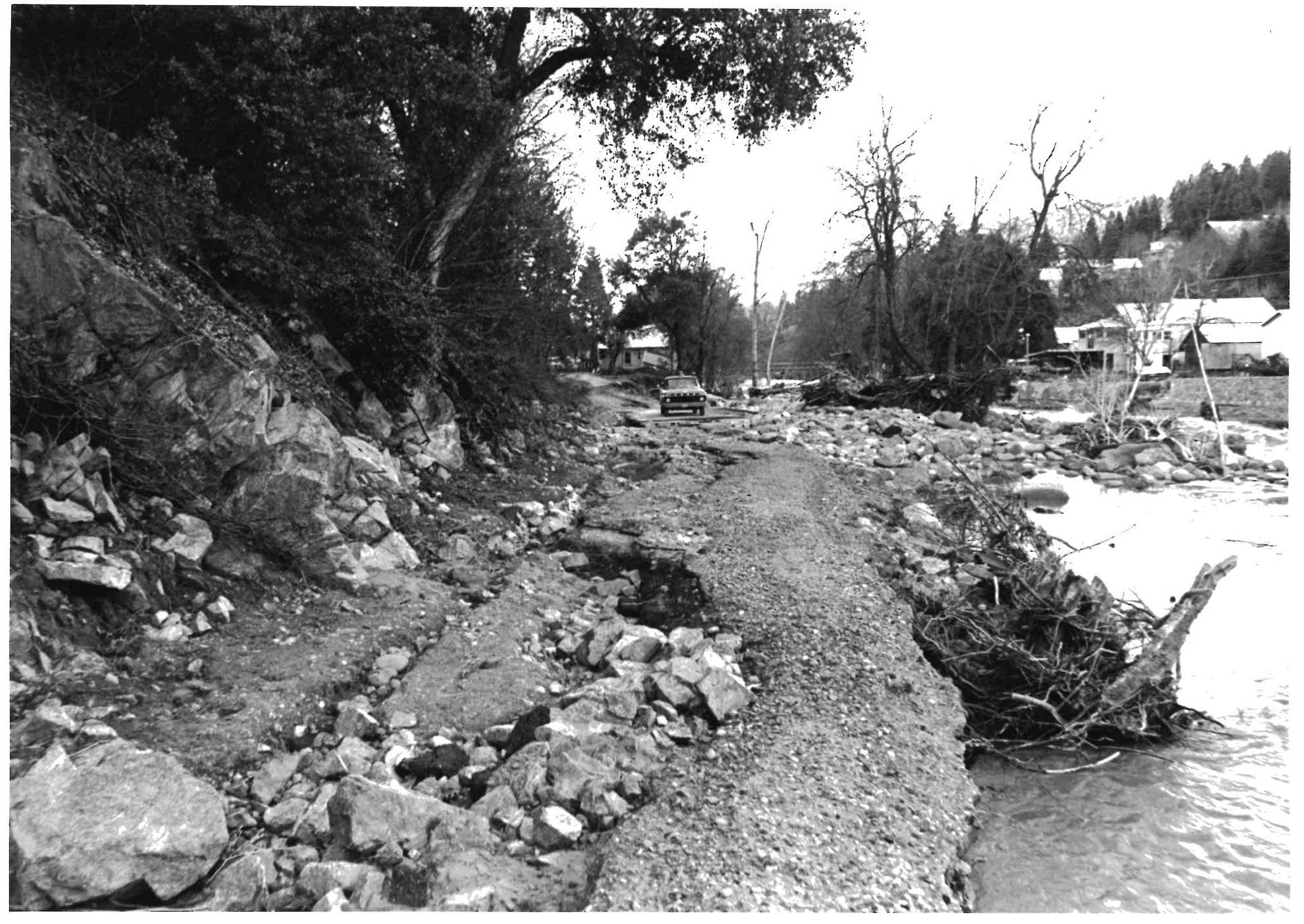
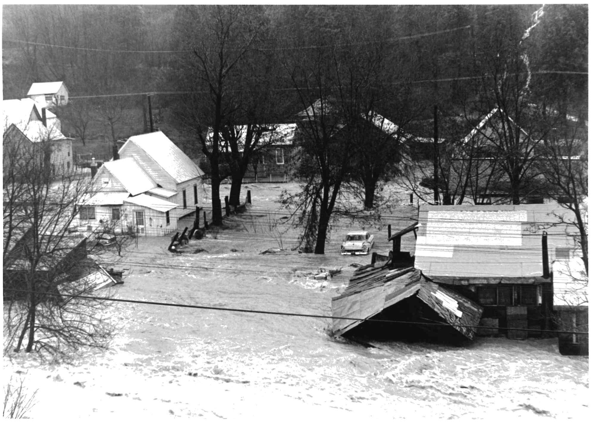


Pictures of the 1964 Flood